Commercial Drone Solutions

Industrial Drone Categories

Specialized drones engineered for demanding commercial applications

INDUSTRIAL SOLUTIONS

Revolutionizing Industrial Operations with Drones

AmurFalcon industrial drones are built for demanding environments, delivering rugged reliability, precision data collection, and operational efficiency. From infrastructure inspection to hazardous material handling, our solutions enhance safety and productivity.

Rugged

Precise

Hazard-Ready

Data-Integrated

MAXIMUM PAYLOAD

Heavy Lift Drones

Designed for material transport and heavy payload operations in construction, mining, and logistics

Powerful Aerial Workhorses

  • 10kg to 100kg payload capacity options
  • Hexacopter/Octocopter configurations for stability
  • Precision load management with auto-tensioning cables
  • IP54 rated for all-weather operations
AmurFalcon Heavy Lift Drone

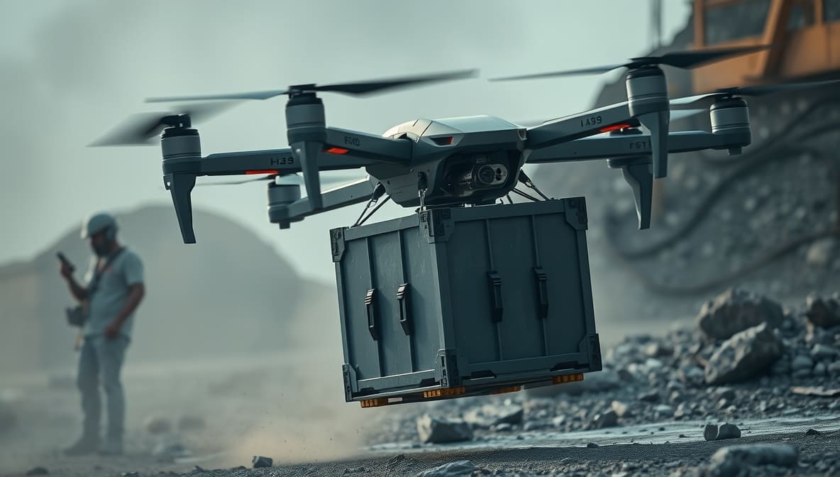
AF-Lift 100 carrying construction materials

AF-Lift 30

30kg payload capacity

45 min flight time (loaded)
10km operational range
IP54 protection

AF-Lift 50

50kg payload capacity

35 min flight time (loaded)
8km operational range
IP54 protection

AF-Lift 100

100kg payload capacity

25 min flight time (loaded)
5km operational range
IP54 protection
INDUSTRIAL GRADE

Inspection Drones

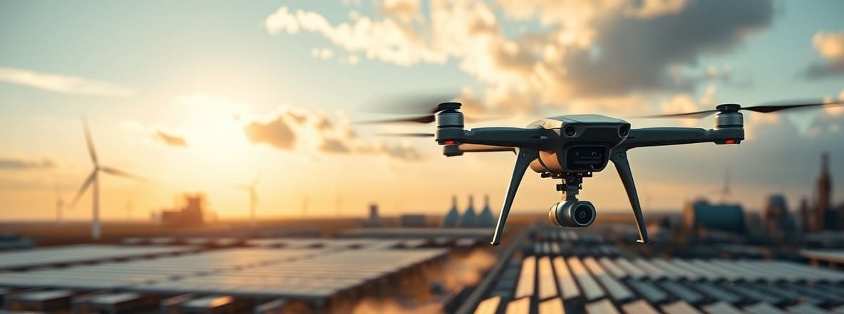
Rugged drones built for inspection, monitoring, and maintenance in harsh environments

AmurFalcon Industrial Drone

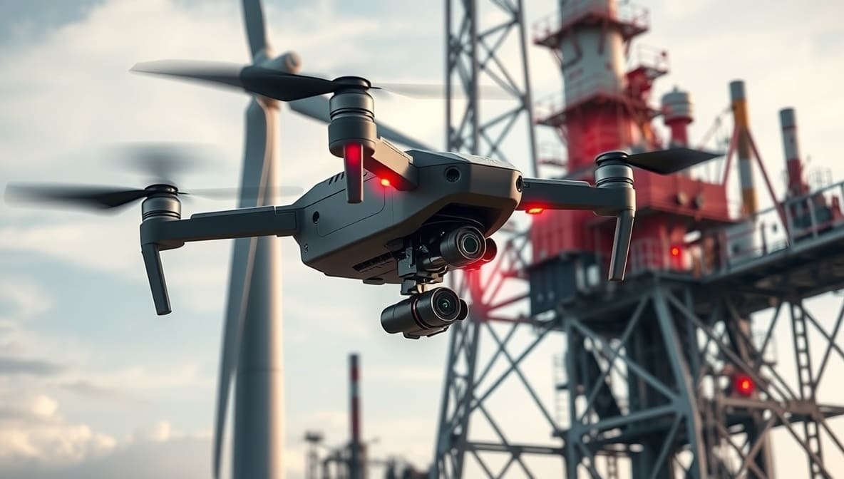
AF-Inspect Pro checking power lines

Mission-Ready Industrial Platforms

  • IP67 rated for dust/water resistance
  • Modular payload systems (thermal, gas sensors, etc.)
  • ATEX certified options for explosive environments
  • AI-powered defect detection with real-time reporting

AF-Inspect Pro

Multispectral inspection drone

4K HDR + Thermal
IP67 protection
90 min flight time

AF-Gas Scout

Hazardous environment drone

ATEX Zone 1 certified
Multi-gas detection
60 min flight time

AF-Industrial X

Custom industrial platform

Modular payload system
IP65 protection
75 min flight time
PRECISION MAPPING

Survey & Mapping Drones

High-accuracy aerial data collection for surveying, construction, and GIS applications

Professional-Grade Geospatial Tools

  • RTK/PPK positioning with centimeter accuracy
  • Multispectral sensors for agricultural analysis
  • Automated flight planning with ground control support
  • Direct CAD/GIS integration for seamless workflows
AmurFalcon Survey Drone

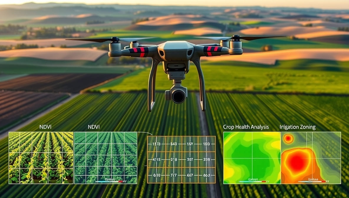
AF-Map Pro creating 3D terrain model

AF-Map Pro

Professional mapping drone

1cm RTK accuracy
42MP full-frame sensor
75 min flight time

AF-Agri Scan

Agricultural survey drone

5-band multispectral
NDVI analysis
90 min flight time

AF-Survey Lite

Compact survey solution

3cm PPK accuracy
20MP mechanical shutter
60 min flight time

Need Help Choosing The Right Industrial Drone?

Our drone specialists will analyze your requirements and recommend the optimal solution